Services
Project Management and Construction Oversight
The professionals at Havy Consulting are your trusted partner in project management, construction oversight, and representation. Our dedicated team of experts are committed to ensuring the success of your construction projects from inception to completion. With Havy Consulting, you can expect unparalleled professionalism, attention to detail, and a steadfast commitment to your project's goals.
Condition Assessment using Ground Penetrating Radar (GPR)
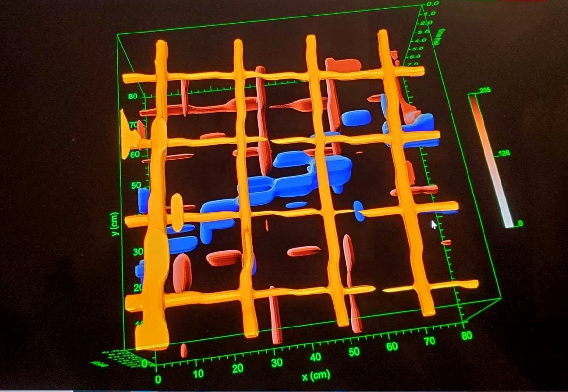
We employ cutting-edge GPR technology to investigate subsurface conditions, locate reinforcement or conduit or utilities, and assess the quality and condition of concrete, providing you with precise data for informed decision-making.
What is GPR
Ground-penetrating radar (GPR) uses a high-frequency (e.g. 10 to 2600 MHz – microwave range) EM pulse transmitted from a radar antenna to explore the subsurface conditions. The transmitted radar pulses are various subsurface features, and this signal is detected by the radar receiver. The reflecting interfaces may be soil horizons, the groundwater surface, moisture saturation, rock/boulder/soil interfaces, ground defect, manmade objects (embedded steel reinforcement in a concrete structure) or any other interface producing a noticeable contrast in dielectric properties (density, moisture content, etc..). The dielectric properties of materials correlate with many of the mechanical and geologic parameters of materials. The emitted radar signal beam is introduced to the ground by an antenna that is in close proximity to the ground (ground coupled method). The reflected signals can be detected by the transmitting (Tx) antenna or by a second, separate receiving antenna (Rx).
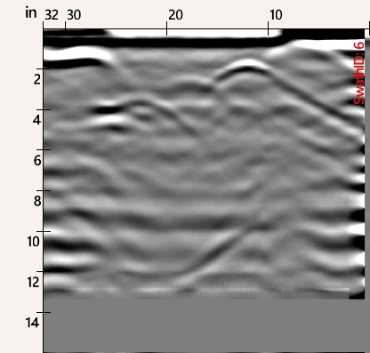
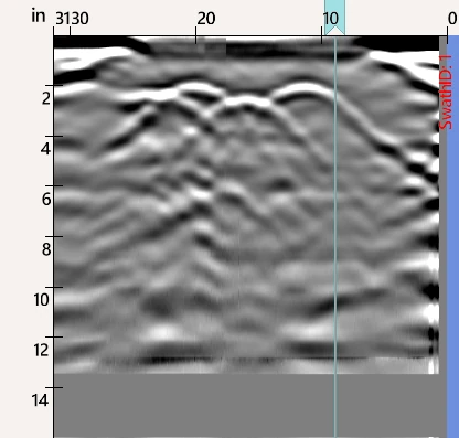
The received signals are processed and displayed in real-time on a graphic recorder. As the antenna (or antenna pair) is moved along the surface, the recorder system displays results in a 2D cross-section record or radar-gram of the subsurface conditions. As GPR has short wavelengths in most subsurface conditions materials (due to its high frequency domain), resolution is in direct proportional with the frequency. When higher frequency antennas are used, it provides high resolution but shallower penetration into materials or manmade structures, which makes these frequencies ideal for scanning concrete slabs and other structures. Whereas when GPR antennas are of lower frequencies, they are ideal for detecting larger, deeper targets.
This service can be utilized for any concrete structure in any environment to enable stakeholders to decide the next steps for the structure in question. This can be prior to renovations to determine what part of the structure can be retained or during construction to ascertain the quality of a questionable concrete pour.
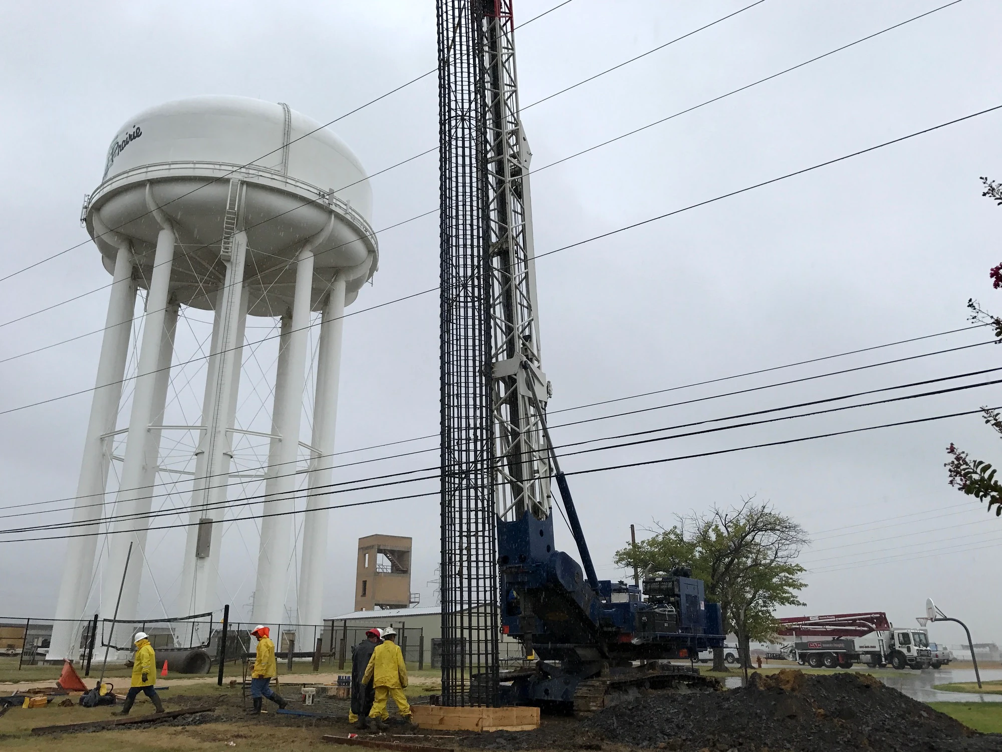
A void survey is highly recommended prior to heavy machinery placement or before any rigging, hoisting is undertaken at a facility. The provided result will show locations where soil quality is different, and inconsistent which will aid stakeholders in selecting the ideal location where a heavy crane can be erected or placed.
At Havy Consulting, we understand the complexities of construction projects, and we're dedicated to making your vision a reality. Contact us today to discuss how we can collaborate on your next project and bring it to successful fruition.